Who asks for this
County weed supervisors, Cooperative Weed Management Areas, state agriculture departments and conservation districts, usually after years of mapping in EDDMapS or ArcGIS that nobody outside the office can see. The data is the hard part and it is already done. The map is a week or two of work.
How we build it
- The map queries your authoritative layer directly over ArcGIS REST or the EDDMapS API. There is no second copy of your data to drift.
- A bundled snapshot paints first, so the map is never blank, then anything new merges in from the live service.
- Filters by species, Utah or state weed class, status (positive, treated, eradicated, negative) and year, with counts that update as you filter.
- Field names are resolved at runtime, so a schema change upstream does not break the public map.
- Built with Leaflet or MapLibre, it loads in seconds on a phone with one bar of service.
- Delivered as a static page you can host anywhere, or hosted on our servers with certificates and backups handled.
What it looks like in service
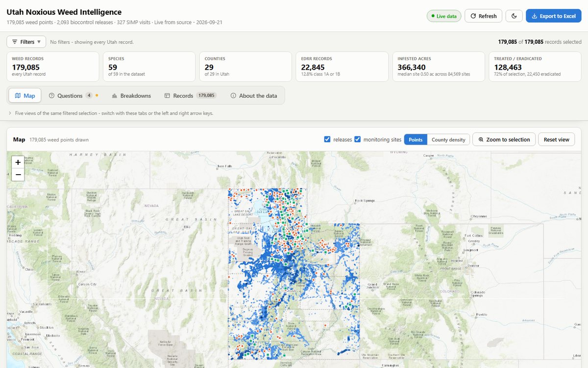
Sanpitch CWMA's map shows 1,500+ county reports from the Utah SIIPA layer the day they are filed. Northern Utah CWMA's six-county map decodes status codes for 55,000+ reports and refreshes hourly. The Utah Weed Supervisors Association's home page shades all 29 counties by report volume with a per-county drill-down. The statewide Utah dashboard reads 179,085 weed records, 2,093 biocontrol releases and 327 monitoring visits from three services on one page.
Questions we are asked
- Do we have to move our data out of EDDMapS or ArcGIS?
- No. The map reads the layer you already maintain. Your crews keep reporting the way they do now, and the public map follows.
- What if our layer is not public?
- Public layers are read directly. For a private layer we publish a snapshot on a schedule, with the fields you choose, and the public map reads that instead. Nothing sensitive leaves your system.
- How current is the map?
- As current as you want it. Our county maps refresh hourly; the Summit CWMA leaderboard is five minutes behind the Survey123 form. A snapshot keeps the map readable even if the live service is down.
- What does it cost to run?
- A static map on our hosting is a small annual line item. There are no per-seat licences and nothing to patch, because there is no CMS behind it.
- Can it go on our existing website?
- Yes. It can be embedded in a WordPress page, as the Western Weed Coordinating Committee's dashboard is, or stand alone on its own address.